Why Barcelona Is One of Europe’s Best Cities for Hiking Day Trips
Barcelona is bordered by the Collserola hills to the west, the Garraf Massif to the south, the Pyrenees foothills to the north, and the Montserrat mountain inland. From the city centre, you can be on a hiking trail in under 30 minutes by metro or train. For active travellers, this is one of Barcelona’s most underrated assets: the Mediterranean cosmopolitan city is wrapped by serious wilderness. This guide to hiking near barcelona covers 10 trails ranging from gentle 1-hour walks to all-day mountain adventures, including the headline routes at Montserrat, Tibidabo, the Carretera de les Aigues, and the Garraf cliffs. By the end of this article you will know exactly which hike fits your fitness, your time, and your interests.
Whether you want a sunset walk that locals do every weekend or a full-day mountain summit, Barcelona has the right trail. We cover everything from the easy collserola hike options to the demanding tibidabo walk, from the garraf hike coastal trails to the iconic Montserrat ridge.
Where to Hike Near Barcelona
The major hiking areas, ranked by accessibility from the city centre:
- Collserola Natural Park (immediately behind the city): 8,000 hectares of forest, hills, and trails.
- Tibidabo (the highest point in Barcelona, 512m): The northern peak of Collserola.
- Garraf Massif (south of the city): Limestone cliffs and Mediterranean scrub forest.
- Montserrat (60 km inland): The dramatic serrated mountain.
- Costa Brava (north of Barcelona): Coastal cliffs and the Cami de Ronda.
- Pyrenees (3+ hours by car): For multi-day mountain hikes.
The 10 Best Hikes Near Barcelona
1. Carretera de les Aigues (Easy)
The 20-kilometre flat path along the side of the Collserola hills, with continuous panoramic views of the entire metropolitan area. Locals walk and run here every weekend. The path follows an old aqueduct route.
- Distance: 20 km one way (do as much as you want; turn back when ready).
- Time: 90 minutes to 6 hours depending on distance.
- Difficulty: Easy.
- Access: FGC train to Vallvidrera Inferior, then 20-minute walk uphill to the path entrance.
- Best for: Casual walkers, runners, anyone wanting city views.
- Tips: Bring water; few fountains along the path.
2. Tibidabo Summit Walk (Easy to Moderate)
From the Tibidabo upper funicular station, several short trails circle the summit, with views over Barcelona, the Mediterranean, and the Pyrenees. Combine with a visit to the Sacred Heart Temple or the Tibidabo Amusement Park.
- Distance: 1 to 5 km circuits.
- Time: 30 minutes to 2 hours.
- Difficulty: Easy.
- Access: FGC L7 to Avinguda Tibidabo, then Tramvia Blau, then funicular.
- Best for: Families, tourists wanting the view without the climb.
For more, see our Tibidabo guide.
3. Bunkers del Carmel and Surrounding Hills (Easy)
The Bunkers viewpoint at 262 metres can be combined with longer walks through the Carmel and Vall d’Hebron neighbourhoods. The wider Collserola park starts just to the north.
- Distance: 3 to 8 km loops.
- Time: 1 to 3 hours.
- Difficulty: Easy to moderate (steep climb to Bunkers).
- Access: Metro L5 El Carmel, then 12-minute climb.
- Best for: Sunset walks with city views.
4. Montserrat Sant Jeroni Summit (Moderate to Hard)
The highest peak of the Montserrat massif at 1,236 metres. The hike from the upper Sant Joan funicular station takes about 3.5 to 4 hours round trip, climbing roughly 350 metres in elevation.
- Distance: 6 to 7 km out and back.
- Time: 3.5 to 4 hours.
- Difficulty: Moderate to hard. Some scrambling near the summit.
- Access: FGC R5 train from Plaça Espanya to Aeri de Montserrat, then cable car or rack railway.
- Best for: Active hikers wanting a dramatic summit.
- Tips: Wear hiking boots; carry 1.5 to 2 litres of water.
See our Montserrat day trip guide.
5. Cami de l’Arrabassada (Easy to Moderate)
A historic trail through the Collserola hills, used since medieval times. Connects multiple villages on the inland side of the hill.
- Distance: 8 km one way.
- Time: 2 to 3 hours.
- Difficulty: Moderate (some climbs).
- Access: Various trail entrances.
- Best for: Local history, quieter trails.
6. Garraf Cliff Walk (Moderate)
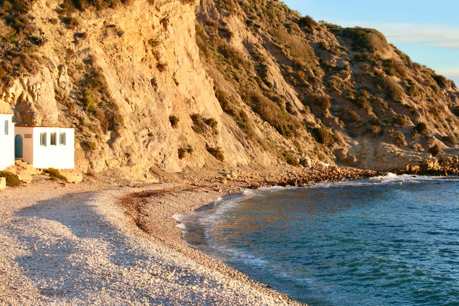
The Garraf Massif south of Barcelona offers dramatic limestone cliffs and Mediterranean scrubland. Multiple trails along the coast and inland.
- Distance: 5 to 15 km options.
- Time: 2 to 6 hours.
- Difficulty: Moderate (rocky terrain).
- Access: Renfe Rodalies R2 Sud to Garraf or Sitges; then trail signs.
- Best for: Geological enthusiasts, sea-view lovers.
- Tips: The white limestone reflects sunlight; use sun protection.
7. Cami de Ronda (Costa Brava Section, Moderate)
The legendary 200-kilometre coastal path along the Costa Brava. Several sections are reachable as day trips from Barcelona; the most accessible runs from Tossa de Mar to Sant Feliu de Guixols (23 km).
- Distance: 5 to 23 km depending on section.
- Time: 2 to 8 hours.
- Difficulty: Moderate (uneven coastal terrain).
- Access: Drive or bus to Tossa de Mar, then walk.
- Best for: Coastal enthusiasts, photographers.
See our Costa Brava guide.
8. Vallvidrera Loop (Moderate)
The historic FGC station Vallvidrera Inferior provides access to a network of Collserola trails. The classic loop goes from the station, up the hill, around the western side, and back via Carretera de les Aigues.
- Distance: 10 to 15 km.
- Time: 3 to 4 hours.
- Difficulty: Moderate.
- Access: FGC L7 to Vallvidrera Inferior.
- Best for: Half-day walks with views.
9. Sant Pere Martir Walk (Easy to Moderate)
The second highest point in Collserola, with a small chapel and panoramic views. A shorter alternative to Tibidabo.
- Distance: 4 to 8 km loops.
- Time: 2 to 3 hours.
- Difficulty: Moderate.
- Access: Metro to Maria Cristina, then bus 75 or 86.
- Best for: Avoiding Tibidabo crowds.
10. Pyrenees Day Hikes (Hard, Drive Required)
For experienced hikers with a car, the Catalan Pyrenees are 2.5 to 3 hours north. Day-hike destinations include La Vall de Nuria, Setcases, and the Vall de Boi UNESCO churches. Allow a full day plus driving.
- Distance: 8 to 20 km.
- Time: Full day with driving.
- Difficulty: Moderate to hard.
- Access: Rental car required.
- Best for: Mountain enthusiasts.
What to Bring on Any Hike
- Comfortable hiking shoes or boots. Most trails have rocky sections.
- Water (1.5 to 2 litres). Many trails have no fountains.
- Snacks. Trail mix, fruit, energy bars.
- Sun protection. Hat, sunscreen, sunglasses.
- Light layers. Higher elevations are cooler.
- Light rain jacket. Mountain weather changes fast.
- Map or downloaded GPS route. Wikiloc or Komoot work well.
- Phone with GPS charge. Power bank backup.
- Small first-aid kit. Plasters, antiseptic, blister care.
- Walking poles. Optional; useful for steep descents.
- Camera. Trails are highly photogenic.
Hiking by Difficulty Level
Easy (1-3 hours, families, casual walkers)
- Carretera de les Aigues (sections)
- Tibidabo summit walks
- Bunkers del Carmel hill
- Some Montserrat ridge walks
Moderate (3-5 hours, regular hikers)
- Vallvidrera loops
- Garraf cliff walks
- Cami de Ronda sections
- Cami de l’Arrabassada
Hard (5-8 hours, fit hikers)
- Montserrat Sant Jeroni summit
- Long Cami de Ronda sections
- Garraf full traverse
Very Hard (8+ hours, experienced)
- Pyrenees day hikes
- Multi-day Montserrat traverse
- Costa Brava long sections
Best Time to Hike
- Spring (March-May): Wildflowers, mild temperatures, ideal conditions.
- Summer (June-August): Hot. Hike before 9:00 AM or after 6:00 PM. Avoid Garraf and exposed routes during midday.
- Autumn (September-November): Excellent. Cool temperatures, golden light, fewer tourists.
- Winter (December-February): Cool but generally hikeable. Snow possible above 1,000 metres.
Weekday hikes are dramatically less crowded than weekend trails. Sunday is the most popular hiking day for locals.
Hiking Etiquette
- Stay on marked paths. Off-trail damages vegetation.
- Pick up rubbish. Carry it out.
- No fires. Strictly forbidden.
- Respect wildlife. Don’t feed or chase animals.
- Yield to uphill hikers. Standard mountain etiquette.
- Don’t pick flowers or break branches.
- Quiet voices. Especially in nature areas.
- Don’t shortcut switchbacks. Causes erosion.
- Bicyclists: yield to walkers.
- Dog owners: leash and scoop where required.
Hiking with Children
- Easy options: Tibidabo summit walks, Carretera de les Aigues short sections, Park Guell free area.
- Moderate options: Vallvidrera loops, parts of the Montserrat ridge from upper Sant Joan funicular.
- Avoid with younger kids: Sant Jeroni summit, long Cami de Ronda sections, Garraf cliff edges.
For more, see our family activities Barcelona guide.
Sample Hiking Day Plans
Half-Day Easy
- 9:00 AM: FGC L7 to Avinguda Tibidabo.
- 9:30 AM: Tramvia Blau and funicular.
- 10:00 AM: Tibidabo summit walks (90 minutes).
- 11:30 AM: Coffee with views.
- 12:30 PM: Funicular and Tramvia Blau back.
- 1:00 PM: Lunch in Sarria.
Half-Day Moderate
- 8:30 AM: Coffee in town.
- 9:00 AM: FGC L7 to Vallvidrera Inferior.
- 9:30 AM: Trail entrance.
- 10:00 AM: Vallvidrera loop (3 hours).
- 1:00 PM: Lunch in Vallvidrera village.
- 3:00 PM: Train back to the city.
Full-Day Hard
- 7:00 AM: Coffee, breakfast.
- 7:30 AM: Train to Montserrat.
- 9:00 AM: Cable car or rack railway up.
- 9:30 AM: Sant Joan funicular up.
- 10:00 AM: Sant Jeroni summit hike.
- 2:00 PM: Lunch at the monastery.
- 3:30 PM: Visit basilica.
- 5:00 PM: Train back.
- 7:00 PM: Back in Barcelona.
Practical Tips
- Use the FGC for Collserola access. Cheaper and faster than driving.
- Download offline maps. Mobile signal is spotty in the hills.
- Tell someone your route. Especially for solo Sant Jeroni hikes.
- Sunday means crowds. Locals fill popular trails.
- Heat warnings: June to August midday sun can be dangerous.
- Bring proper hiking boots for rough terrain.
- Carry change for funiculars and cable cars.
- Don’t hike alone in remote areas.
- Mosquitos: Pack repellent for evening trails.
- Wild boar: Common in Collserola at dawn and dusk; harmless if you don’t approach.
Frequently Asked Questions
What is the best easy hike near Barcelona?
Carretera de les Aigues for views; Tibidabo summit walks for accessibility.
What is the best long hike?
Sant Jeroni at Montserrat for drama; the Tossa de Mar Cami de Ronda for coastal beauty.
Can I hike directly from the city?
Yes. The Carretera de les Aigues is reachable in under an hour from the city centre via FGC.
How long are most hikes?
2 to 4 hours for half-day options; 4 to 8 hours for full-day adventures.
Do I need a guide?
Most popular trails are well-marked. A guide is optional but useful for first-time visitors to Montserrat.
What if I get lost?
Stay on the trail. Call 112 if injured. Bring a fully charged phone.
Are dogs allowed?
Yes on most Collserola and Montserrat trails. Some specific zones require leashes.
When does it get dark?
Sunset varies by season. Summer sunset is around 9:30 PM; winter is 5:45 PM. Check before starting late hikes.
Can I bike instead of hike?
The Carretera de les Aigues is bike-friendly. Mountain bike rentals available; see our Barcelona bike rental guide.
What about hiking insurance?
Standard travel insurance usually covers hiking. For Pyrenees mountaineering, additional coverage is recommended.
Are there hiking groups?
Yes. Several local groups (Catalan Hiking Federation, expat meetups) organise weekend hikes. Check Meetup.com or local Facebook groups.
What is wikiloc?
A popular GPS hiking app with thousands of trails downloaded by locals. Excellent for finding routes.
How do I get to Garraf?
Renfe Rodalies R2 Sud train from Barcelona Sants to Garraf station. About 30 minutes.
Should I take a taxi back from a remote trail?
Free Now and Cabify work in Vallvidrera, Tibidabo, and Sant Pere Martir. Cash taxis less reliable.
Final Thoughts: A Wilderness Right at the City’s Edge
Barcelona’s hiking near barcelona options are one of the city’s quietest pleasures. The Collserola hills are 30 minutes from the centre; Montserrat is just over an hour; the Costa Brava and Pyrenees open up for longer trips. Pick one trail per visit, build a half-day around it, and you will see a side of Catalonia that most visitors never experience. The Mediterranean cosmopolitan city is just one part of the story; the wild hills behind it are the other half.
For more, see our Barcelona beaches and outdoors pillar, the best beaches in Barcelona guide, the Montserrat day trip, and the best views in Barcelona for the panoramic spots.